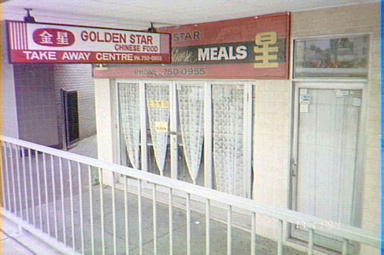
Era: 1990 and beyond Cultural background: English, Italian, Jewish, Lebanese, Pacific Islander, Russian, Spanish Theme:Convicts Environment Exploration Food Government Indigenous Relations Photography Pop culture Refugees Settlement Shops
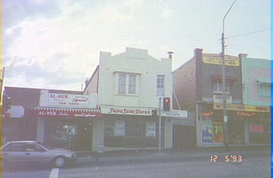
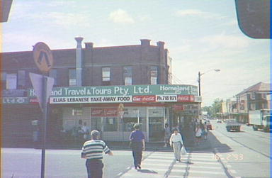
Al-Nur next door to a Supa Save Stores possibly on Lakemba Street at the intersection of Haldon Street, Lakemba, 1993. Courtesy City of Canterbury Council
Collection
Canterbury City Council, Campsie, Australia.
Object name and number
Greg Ritchie Negative Collection.
Object Description
The Greg Ritchie Negative Collection is a collection of over 3000 negatives featuring buildings and other sites in the City of Canterbury. Between 1990 and 1998 Canterbury City Council staff documented their day-to-day duties through photographs. Staff used shared cameras to photograph sites and places to attach to the Development Applications, reports, surveys, or other documents being compiled. This resulted in a collection of negatives initialled and dated by staff as they were packaged for distribution to other workers.
The collection of negatives was donated to the City of Canterbury Local History Photograph Collection by Greg Ritchie before a major departmental restructure and refurbishment of the Canterbury City Council Administration Building.
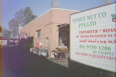
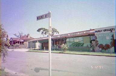
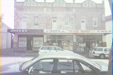
What remains is a photographic time capsule of the cultural landscape of the Canterbury area between 1990 and 1998. The Canterbury area has in recent decades been the destination for migrants from all over the world seeking a better life in Australia. The result is that the municipality is one of the most multi-cultural communities in Australia with a great diversity in the cultural and visual landscape. This Collection of negatives documents this time.
History of Migration to Canterbury
Aboriginal people were living in the Sydney area for at least 10,000 years before the arrival of the British settlement in 1788. Occupation sites are places where there is evidence of use by Aborigines. Rock shelters or caves gave protection from the weather and were used for cooking and camping and may show evidence of fires. Middens, made up of shells discarded from shellfish meals over hundreds of years are located in Canterbury, near Cooks River and Wolli Creek. Cooks River was a rich source of fish and seafood, including prawns, crabs, cockles, mussels and oysters.
A 1986 survey of the Wolli Creek Valley by Tranby Aboriginal Cooperative College identified 24 rock shelters that Aborigines may have used, and two middens. Wolli Creek is a tributary of Cooks River. Many rock shelters across Sydney contained art-work. Hand stencils were the most common form, and were probably produced by blowing a mixture of white pipe-clay and water over the object being stencilled, leaving a negative image.
The land area along and near the Cooks River was first explored by Captain Cook’s Officers, in 1770. It was subsequently settled very early in the European establishment of Sydney, because of its fertility. The area’s first land grant was made to the Chaplain of the First Fleet, the Reverend Richard Johnson, in 1793. He was one of the best farmers in Sydney successfully growing corn, wheat, fruit, grapes and livestock. His grant contributed to the opening up of the area to later farming settlers.
Canterbury Vale was the name he gave to the grant he took up, just north of the Cooks River. The first grant south of the river was made to Mrs Hannah Laycock by Governor King that she named Kings Grove Farm in the Governor’s honour. In early years timber was a chief resource resulting from the clearing of land for vegetable and crop growing and grazing.
Cooks River was a barrier between farms south of the river and the Sydney market. This barrier meant that development was hampered and population remained sparse on the south side for the early part of the nineteenth century. Poor access due to lack of public transport, unmade roads and a lack of bridges restrained expansion and development.
After the extension of the railway line from Sydenham to Belmore in 1895, Canterbury’s population grew steadily as farms were subdivided into housing blocks. Speculative builder developers hoped to make money on building new suburbs connected to Sydney with the new public transport system the rail line provided. The suburbs of Canterbury, Hurlstone Park, Campsie and parts of Belmore grew when the population doubled from 1901 to 1911, and then trebled between 1911 and 1921. When the railway was extended from Belmore to Bankstown in 1909, Lakemba and Punchbowl boomed. Gradually water, electricity and sewerage were connected.
The 1920′s were also boom years as the tram network was extended into the area making the municipality more accessible. Canterbury’s population doubled again between 1921 and 1933, and the number of buildings increased from less than one thousand in 1901 to more than 18,000 by 1933.
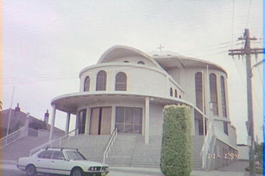
All Saints Greek Orthodox Church, 33 Isabel Street, Belmore, c.1994. In 1963, a group of parents established a Greek Orthodox Community at Belmore. The new church was officially opened on 10th June 1972. Courtesy City of Canterbury Council
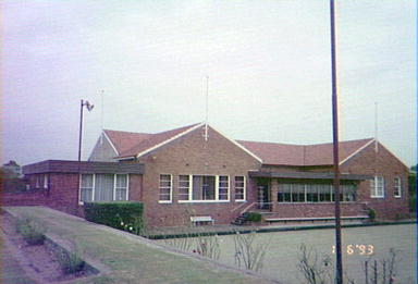
Ashbury Bowling & Pan-Arcadian Federation Club, 55 King Street, Canterbury, 1993. Courtesy City of Canterbury Council
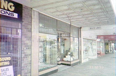
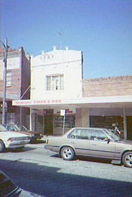
Clockwork Music next door to Bizzaro Bridal and Evening Wear in Homer Street, Earlwood, 1993. Courtesy City of Canterbury Council
Before 1945 most settlers were of English, Scottish or Irish cultural heritage, although there were Chinese market gardeners in the late 1800s, and the first Lebanese-born shopkeeper set up in Campsie in 1916. Many post war migrants from Europe settled in Canterbury, particularly Greeks and Italians.
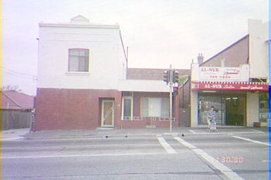
Al-Nur Salon at 205 Lakemba Street, Lakemba. The double storey building on the left is 209 Lakemba Street, Lakemba, 1990. Courtesy City of Canterbury Council
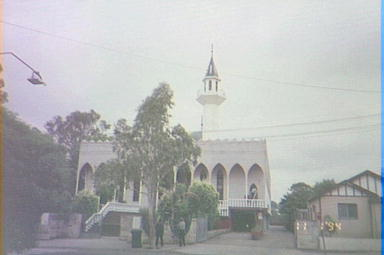
Ali Ben Abi Talib Mosque, known as Lakemba Mosque, 65-67 Wangee Road, Lakemba, c.1994. Courtesy City of Canterbury Council
The civil war in Lebanon in the 1970s saw the start of a large migration of Lebanese, of both Christian and Muslim faiths. Chinese migrants have come in large numbers since the late 1980s.
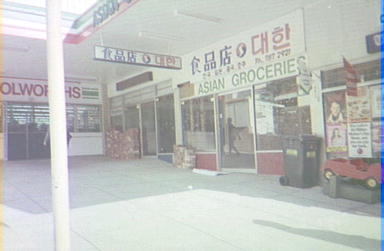
An Asian grocery store and other shops near the entrance to Woolworths at 68 Aevaline Street, Campsie. C.1991. Courtesy City of Canterbury Council
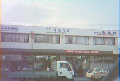
The area has a small community of Korean migrants who run the many Korean restaurants in Beamish Street Campsie. Canterbury now has small but emerging communities from Africa and the Pacific Islands.
Immigrants have come in waves, but not all have stayed. A small Jewish community that had become established in the 1950s moved to the Eastern suburbs in the 1970s and Spanish migrants from the 1970s moved elsewhere as new communities become established.
Canterbury is distinctive for its diverse population with its high proportion of migrants. The Canterbury Council’s elected councillors now reflect the multicultural nature of Canterbury’s population, including councillors who come from Greek, Lebanese, Italian and Korean backgrounds.
The collection of negatives has historic significance as tangible evidence of post World War Two mass migration changed the cultural and urban landscape of this area of Sydney. The photograph collection is evidence of the ambitions of the migrants from many differing cultural backgrounds to set up families and enjoy a prosperous life in Australia.
The collection of negatives has intangible significance as a reminder of the experience of thousands of post war migrants in migrant accommodation with basic living conditions.
The collection of negatives has research significance as a rare resource documenting the cultural and architectural landscape of a suburb during the 1990s.
The collection of negatives represents a time when Australia population was undergoing massive change from predominantly British culture embracing people from other nations. The Australian government discarded the ‘White Australia Policy’ in the 1950s and assisted the migration of nearly 200,000 people from Europe, Mediterranean, Asia and the Pacific.
The interpretive potential of the collection of negatives is considerable. The collection interprets the attempts by the Australian government to build up Australia’s population of migrants and manage massive demographic change in the suburbs of the Nation’s capital cities and towns.
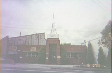
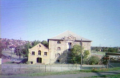
Factory, Canterbury Rd, Canterbury, 1993. This building was originally the A.W.A. (Amalgamated Wireless Australia) Factory. Courtesy City of Canterbury Council
Bibliography
Coupe, S & Andrews, M 1992, Was it only Yesterday? Australia in the Twentieth Century World, Longman Cheshire, Sydney.
Heritage Office & Dept of Urban Affairs & Planning 1996, Regional Histories of NSW, Sydney.
Heritage Collections Council 2001, Significance: A guide to assessing the significance of cultural heritage objects and collections, Canberra.
Websites
Migration Heritage Centre
August 2010
Crown copyright 2010©
The Migration Heritage Centre at the Powerhouse Museum is a NSW Government initiative supported by the Community Relations Commission.
www.migrationheritage.nsw.gov.au
Regional Services at the Powerhouse Museum is supported by Movable Heritage, NSW funding from the NSW Ministry for the Arts.


